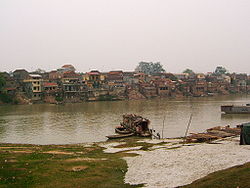
BAC GIANG PROVINCE
Square: 3827,8 km2
Population: 1560,3 thousands people (2010)
City: Bac Giang City
Districts: Son Dong, Luc Ngan, Luc Nam, Yen The, Lang Giang, Yen Dung, Viet Yen, Tan Yen, Hiep Hoa.
OVERVIEW:
Bắc Giang is a province of Vietnam. It is located in the northeastern part of the country, being situated 50 kilometres (31 mi) to the east of the Vietnamese capital, Hanoi. The province covers an area of 3827.45 square kilometres and as of 2008 it had a population of 1,628,400 people.
Bắc Giang Province, Lao Cai, Bắc Kạn, Cao Bang, Ha Giang, Lang Son, Phu Tho, Quang Ninh, Thai Nguyen, Tuyen Quang and Yen Bai of the Đông Bắc (Northeastern Region) are part of the 59 administrative provinces and 5 municipaltites in Vietnam.
Bắc Giang history is traced to the Hung Kings who established the Văn Lang nation, then followed in succession the rule of the Lê Dynasty and the Nguyen Dynasty. It was the prefecture of Đa Phúc during the time of Emperor Tu Duc, Vietnam’s last independent monarch. However, the modern province of Bắc Giang was founded in 1895.
The province lies in the Red River Delta and borders Quảng Ninh to the east, Lạng Sơn to the north, Thái Nguyên and the urban district of Sóc Sơn in the capital Hanoi to the west, and Bắc Ninh and Hải Dương to the south.
Industrial development has been planned intensively in this predominantly agararian province and as result there is discernible improvements in its economic conditions.
The province has many places of interest to visit such as the Xuong Giang Ancient Citadel, Cam Son Lake, Duc La Pagoda, Tho Ha Communal House.
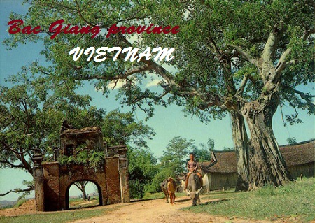
Bac Giang province - Vietnam Tourism
HISTORY:
During the time of the Hung Kings, who started the nation of Văn Lang, Bắc Giang was in the division of Võ Ninh.
During the Lê Dynasty, the province was the prefecture of Bắc Hà. Following the ascent of the Nguyen Dynasty, it became the prefecture of Thiên Phúc in 1822, before becoming the prefecture of Đa Phúc during the time of Emperor Tu Duc, Vietnam’s last independent monarch. From November 5, 1889 to September 9, 1891 there existed the province of Lục Nam. It comprised the districts of Bảo Lộc, Phượng Nhỡn, Lục Nam, Hữu Lũng (split from Lạng Giang and Bắc Ninh Province) and the district of Yên Bái (split from Lạng Sơn Province). In 1891 after the return of the districts of Bảo Lộc and Phượng Nhỡn back to Bắc Ninh Province, Lục Nam was abolished and integrated into Đạo Quan binh I.
The modern province of Bắc Giang was founded on October 10, 1895, when it was created out of Bắc Ninh Province. It initially comprised the prefectures of Lạng Giang and Đa Phúc and the districts of Kim Anh, Yên Dũng, Phượng Nhỡn, Việt Yên, Hiệp Hòa, Yên Thế and some small territories south of the Lục Nam River. The province capital was Phủ Lạng Thương, which is now the city of Bắc Giang. In 1896, the prefecture of Đa Phúc and the district of Kim Anh was returned to Bắc Ninh Province.
In 1950, Bắc Giang was put into the Confederation of Northern Vietnam (Liên khu Việt Bắc) by the communist Vietminh and comprised seven districts: Hiệp Hoà, Lục Ngạn, Yên Thế, Lạng Giang, Việt Yên, Yên Dũng, Hữu Lũng.
On February 22, 1955, the district of Sơn Động of Quảng Yên Province was incorporated into Bắc Giang Province. On July 1, 1956, upon the formation of the Autonomous Region of Northern Vietnam (Khu tự trị Việt Bắc), the district of Hữu Lũng was transferred to Lạng Sơn Province. On January 21, 1957, the districts of Sơn Động and Lục Ngạn were divided into the three districts of Sơn Động, Lục Ngạn and Lục Nam. On October 27, 1962, Bắc Giang merged with Bắc Ninh into the new province of Hà Bắc, until it was re-partitioned on January 1, 1997 into its previous components.
GEOGRAPHY:
Bắc Giang lies in the Red River Delta. It borders Quảng Ninh to the east, Lạng Sơn to the north, Thái Nguyên and the urban district of Sóc Sơn in the capital Hanoi to the west, and Bắc Ninh and Hải Dương to the south. It comprises three land forms namely, the lowland or the delta land, the midland and the mountainous region. While the midland areas are in the districts of Hiep Hoa and Viet Yen and the Bac Giang city, the mountanous districts are the Son Dong, Luc Ngan, Yen The, Tan Yen, Yen Dung, Lang Giang; the seven mountanous districts account for 72% of area of the Bac Giang province.
Of the total land area of the province, 123,000 hectares (300,000 acres) is agricultural land,110,000 hectares (270,000 acres) is forest land, 66,500 hectares (164,000 acres) is residential and urban land and for other uses. The farmland in the proivnce is good intensive farming of rice crops vegetable, fruit and bulb trees. There is scope for expanding land under forests. The produce from the forests has been estimated as 3,5 million m3 of wood and 500 million trees of bamboo and neohouzeaua.
Bắc Giang occupies an area of 3,827.45 square kilometres (1,477.79 sq mi),[9] which is 1.2% of the area of the whole country. According to statistics from 2000, 32.4% of the land is used for agriculture, while 28.9% is used for forestry, industry or is otherwise uncleared. The remainder comprises mountains, unexploited waterways and land used for miscellaneous purposes.
The province is 50 kilometres (31 mi) from Hanoi and has a good network of roads such as the National Highways No. 1A, 31 and 279. It has railway lines from Bac Giang to Hanoi, Lang Son, Thai Nguyen and mineral areas in Quang Ninh by train.
The terrain is moderately mountainous, lying between the high mountains to the north and the Red River Delta to the south. Although a large part of the terrain is mountainous most of it is not isolated. The region to the northern end of the province is mountainous uncleared forest. To the east and southeast of the province is Đông Triều and the Mount Yên Tử, located with the Yên Tử Nature Reserve. The elevation of the province is mostly in the 300–900 metres (980–3,000 ft) range, with a maximum of 1,068 metres (3,504 ft) (Mount Yên Tử). To the northeastern end of the province, along the border with Quảng Ninh there is the Khe Rỗ forest, spanning 71.53 km2, with a rich biodiversity.
Bắc Giang has a total of 347 km of rivers and springs, the three most prominent being Lục Nam River, Thương River and the Cầu River. Apart from waterways, Bắc Giang has many lakes, including Cấm Sơn Lake and Khuôn Thần Lake; the area covered by ponds, lakes and lagoons is 16,300 hectares (40,000 acres). Cấm Sơn Lake lies in Luc Nagan district of the province in the area bordering the province of Lạng Sơn. It is30 kilometres (19 mi) long and has a width varying from 200 metres (660 ft) up to7 kilometres (4.3 mi). It has an area of 26 square kilometres (10 sq mi), but this can increase to 30 kilometres (19 mi) during monsoonal flooding. Khuôn Thần Lake has an area of2.4 square kilometres (0.93 sq mi) and the centre of the lake has five small hilly islands surrounded by 20-year-old pine forests. Pedalboating and motorboating are permitted on the lake. Ethnic minority hamlets are located on the shores of the lake. Apprroach route to the lake is from Bac Ninh - 31 kilometres (19 mi)), then to Bac Giang - 51 kilometres (32 mi)), further to the Hoa River-98 kilometres (61 mi) and finally arrive at the Cam Son Lake.The highest flow in the Thuong River is reported to be 64.4 m3/s and lowest flow is 12.9 m3/s.
CLIMATE:
The province has the dominant charechteristics of the tropical and temperate climate zone of the Northern Plain. The temperature, humidity and rainfall indexes clearly vary over months and seasons. The climate in the province has been discerned in two distinct seasons - the hot, rainy season from May to September and the cold, dry season from November to March. The average temperature varies between 22–23 °C (72–73 °F); the Maximum Temperatures recorded was 41 °C (106 °F) while the lowest temperature was 13 °C (55 °F). Humidity values are in the range of 73% to 87%. The average rainfall is reported to be 1,953 millimetres (76.9 in). The annual Sun shine hours of 1,500 to 1,700 hours is good to grow tropical and subtropical trees. The average wind velocity is 2.1 metres (6.9 ft)/s and average atmosphere pressure 757.71 mmHg. Since the province is located away from the East Sea, the incidence of hurricanes and storms is rare though Whirlwind and hail storm are a localised phenomenon in a few mountainous districts.
TOURISM:
Bac Giang has many beautiful sites and vestiges such as Khe Ro Primitive Forest, Suoi Mo Site, Xuong Giang Ancient Citadel Other interesting sights as Cam Son Lake, Khuon Than Resort.
The province has cultural traditional festival of Kinh Bac people, as well as spring festivals of ethnic groups.
TRANSPORTATION:
Bac Giang is 51km from Hanoi.
Road: There are national highway No. 1A, 31, and 279.
Railway: From Bac Giang to Hanoi, Lang Son, Thai Nguyen, and mineral area in Quang Ninh by train.
You are pleasure choice a city!
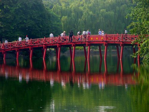
62 hotels
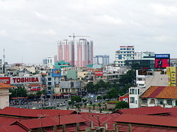
48 hotels
1 hotels

2 hotels
11 hotels

5 hotels
11 hotels
24 hotels
1 hotels
1 hotels
1 hotels
1 hotels
17 hotels
2 hotels

3 hotels